Spaceman Spiff
Well-known member
Who thinks the flooding is due to natural causes?
As opposed to what un-natural causes?
Who thinks the flooding is due to natural causes?
Why have we not had such bad flooding prior to 2017?
We have had similar or greater snow amounts in winter, followed by heavy rains in the spring.

Why have we not had such bad flooding prior to 2017?
We have had similar or greater snow amounts in winter, followed by heavy rains in the spring.
Changements climatiques? Pas pour te décourager mais sa va être de pire en pire...
Ou tu crois pas à ça non plus?
Le ministère des Transports réalisera des travaux de réfection majeure sur le pont Proulx, situé dans l'axe de l'autoroute 20, à quelques mètres à l'ouest du pont Galipeault, à L'Île-Perrot.
Ces travaux débuteront dans la semaine du 31 août et s'échelonneront jusqu'en octobre 2016. Ils consistent essentiellement à remplacer la dalle, à réparer les unités de fondation ainsi qu'à remplacer les appareils d'appuis et les joints de tablier de la structure.
Ces interventions permettront ainsi d'assurer un lien essentiel sur l'autoroute 20 et prolongeront la vie utile de la structure.
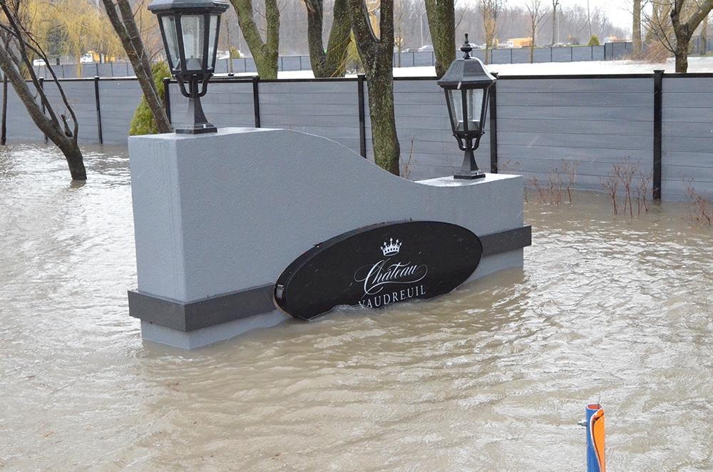
Ils étaient jaloux du château d'eau de Ste AnneJe pense que je vais annuler ma réservation au Château Vaudreuil.
https://www.viva-media.ca/wp-content/uploads/dsc_0200-wb.jpg
What about Lachine though?What people seem to forget is that most of these flooded areas have always been natural flood plains. Most of the Montreal and south shore are. We have just been lucky in recent years
I'm not in town right now, in sunny Orlando. What I'm told is the bike path is flooded out and some of the park. It's what happened a few years ago, they built a 4 ft dike at 45th. My father in law lives on the corner of 54th and Lakeshore for like 1000 years. He said once or twice it made it across the street.What about Lachine though?
Sent from my SM-G950W using Tapatalk
Totally different flood....https://www.google.ca/search?q=decarie+highway+flood&ie=UTF-8&oe=UTF-8&hl=en-ca&client=safari
Sent from my iPhone using Tapatalk
Totally different flood....